Saturday, June 13, 2009
How I Became a Risk Champion
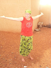
Ok thats a lie. I've never even played Risk. But it is a nice lead in to what I really want to talk about, which are the maps that I painted in the primary school in my village. I painted a map of the world, (which is where the Risk comes in, I'm all about world geography now) a map of Africa and a map of Niger on three walls in one of the classrooms. I may be a bit biased, but they are quite lovely. When I began this project (in February) I thought it would be a small "filler" type project to get me started on bigger and better things. I forgot to take into account that Niger runs on Africa time (probably because it's on the continent of Africa...) and things don't go as planned. I began by writing a propasal for funding from a source in Peace Corps which took about a month to get into the right hands. When it found its way there I was informed that it would be much easier to simply buy all the supplies and I could get reimbursed for money spent. One month down. It took another month-ish to get all the supplies from various stores and men selling things under shade hangars, and then I decided to wait for a Peace Corps car to bring the supplies to my village because travel in Niger is difficult without lugging around gallons of paint. When I finally got everything I needed to where I needed it to be, including "borrowing" paint from other volunteers, it was about mid April. My goal was to finish the maps by the time I left for vacation in mid May. I figured it would take about a week. That was dumb. Most buildings in Niger aren't made as well as in the states, so just drawing the rectangles on which I would paint the maps was a nightmare because none of the windows, doors or ceilings are properly aligned. I managed to get decently even rectangles that fit my size specifications and, with the help of a neighboring volunteer, painted the squares ocean or desert color (for the backgrounds) and drew grid lines to make drawing the countries more accurate and loads easier. We tried to let some of the village kids help with the painting and that was much more chaotic than I anticipated, and it set a low standard of respect that unfortunately haunted me for the rest of the project. Amidst rude shouting from kids who would periodically run in to steal our candy or chalk, we managed to draw the world, Africa, and Niger in one weekend. When my friend left, I assumed I could finish the rest of the work within the week. Yet again I was oh so wrong. In Niger, students have a 3 hour lunch break from 12:00 to 3:00 and end school at 5:30, and they don't have school on Wednesday afternoons. I thought that by painting the countries during that break, the hour and a half after school before dark, and Wednesday afternoons I could finish quickly. Like I said, oh so wrong. I think I forgot that I'm not a super hero or an artist, so painting tiny countries or borders like nothern Russia and eastern Canada and Greenland is rather time consuming. When I got sick during my map project, I actually had feverish nightmares about the Russian border and how hard it was to paint! Another unexpected problem was mixing paints. My purple is less than desirable, and I spent many painful hours just trying to get there. As the headmaster of the school told me when he came to check up on my progress, "Blue and Red make purple!" He repeated this about 400 times while throwing my important papers around in his excitment. "Yes I know that... I've tried multiple times... the consistencies aren't mixing properly... OK thanks I'll do that! You're so helpful!" Painting took the better part of 3 weeks. I was working so often that I was neglecting visiting my friends and spending time talking to people, which is a major part of this culture. So I decided to work only on Wednesday afternoons and weekends and spend my other afternoons with my friends in village. My stress level went way down and productivity way up after that brilliant epiphany. After what seemed like speeding through painting my countries, my closest volunteer neighbor came to label the countries for me (as my handwriting is awful) and help me paint the national anthem above two of the maps. So I finished my goal despite the village kids' best efforts. My maps were done by the time I went to vacation in mid May. I've been gone since then and I'll be going back to my village the day after tomorrow so I haven't done any sort of education with the maps yet. I plan on using them mainly to teach about HIV and AIDS, where it is more prevelent and how to prevent it from traveling to Niger. My favorite part about this project was seeing my friends stop by to watch me work. It felt amazing to know that people cared about what I was doing enough to come by and see it and learn more about geography in the process. Everyone seemed very interested in where America is, where California is, and how it really is quite far from Niger. And of course, as I said in my last blog, dancing with Muhammadu.
Subscribe to:
Post Comments (Atom)
4 comments:
hey kelsey! long time no talk! don't really have a whole lot to say, just wanted you to know i read your blog and i thought it was cool. drop me a line sometime. take care buddy.
Paul DeSurra
paulstar.drummer@gmail.com
Woohoo! Geography! This post reminded me of a geography major I once knew, or so he told me. Think his name was Andy, yes. Andy Graham...
Hope you had a great vacation, continue the wonderful work in Niger!!!
Oh man...I would have loved to see the craziness that went on with painting those maps. Sounds really cool though! I love geography! I don't really love you though...
jk!
Hope your vacation was fantastic. Did you get to a beach? Want to hear more about where you went. Keep writing and I'll keep trying to get in to answer. Love ya.
Hugs from Gma K
Post a Comment